Home >Technology peripherals >AI >Changji City uses drones to implement all-weather dynamic river inspections
Changji City uses drones to implement all-weather dynamic river inspections
- WBOYWBOYWBOYWBOYWBOYWBOYWBOYWBOYWBOYWBOYWBOYWBOYWBforward
- 2023-07-14 20:29:38884browse
Changji City uses drones to achieve all-weather dynamic inspection of rivers
Changji Daily News (Correspondent Liang Hongtao Liu Hua) In order to further improve the efficiency of river patrols, we will increase all-weather and full-time patrol inspections of the Santun River Basin. On July 6, Santun, Changji City The River Basin Management Office took advantage of the advantages of drones' high-view display, all-round shooting, and no blind spot monitoring to conduct an aerial inspection of the Santun River Basin for the first time, innovatively opening a new model of "drone artificial" water ecological inspection and supervision, and realizing The dynamic inspection of rivers in Changji City spans from plane to three-dimensional.
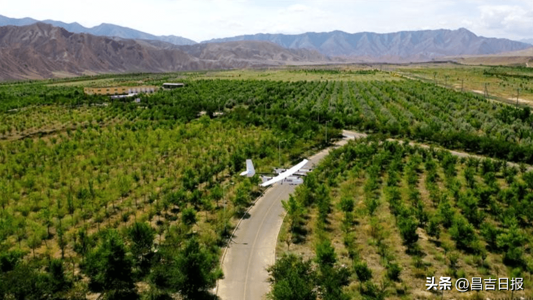
On that day, with the sound of a "buzz", a drone model named JOUAV CW-15 (Zongheng Dapeng CW-15) quickly took off and began to cruise autonomously according to the set route. Dynamic inspection of the Tunhe River Basin was carried out. This wing has a wingspan of 3.6 meters, can fly continuously for 3 hours, reaches a maximum flight altitude of 6,500 meters, and has a cruising speed of 90 kilometers per hour. Because it is equipped with surveillance, orthogonal pods, and oblique aerial cameras, the drone can quickly acquire on-site raw image data and geographical data while flying, and transmit it to the ground control system in real time, providing supervisors with timely and accurate latest information. .

On July 6, the drone operator was setting the drone flight parameters in the ground control room. Photo by Liang Hongtao
Pan Yong, a senior engineer at the Information Center of the Santun River Basin Management Office in Changji City, said: "The drone monitoring gondola can conduct inspections of rivers in key areas through video thermal imaging, and the orthogonal gondola can collect high-definition images of the river area. , by comparing the images of the river in various periods, we can understand the changes in the river and realize automated and precise inspection of the river, thereby improving work efficiency."
The Santun River Basin in Changji City includes the Santun River water source channel, two mountainous reservoirs, two canal heads, a main canal, etc. The river course is winding, with a total length of about 30 kilometers. River inspection tasks are high-intensity and difficult to supervise. Shi Wenjing, director of the Information Center of the Santun River Basin Management Office in Changji City, said that in order to grasp the situation of locations that cannot be reached manually, that is, the natural river channel between two mountainous reservoirs, a drone intelligent inspection system was specially introduced.

On July 6, a drone conducted an aerial inspection of the river reservoir area. Photo by Liu Hua
The use of drones breaks through the space limitations of inspection and supervision, and is fast, clear in video, and covers a wide range. It can serve as an all-round aerial "inspector" of rivers without blind spots. It can not only efficiently inspect and Shooting and recording live river information has also achieved new breakthroughs in the river inspection and supervision model from land to air, from plane to three-dimensional, further expanded the scope of inspection and supervision of river water bodies, and broke through daily constraints in terms of time, scope, manpower and other aspects.
"It takes more than half a day to manually inspect the natural river between the two reservoirs. It only takes about 30 minutes to fully understand the condition of the natural river between the two reservoirs. Thanks to this set of intelligent unmanned aerial vehicles Machine inspection system. During the inspection process, the picture can be transmitted in real time and displayed clearly, so that problems can be discovered in time and people can be quickly dispatched to deal with them." Shi Wenjing said.
The above is the detailed content of Changji City uses drones to implement all-weather dynamic river inspections. For more information, please follow other related articles on the PHP Chinese website!
Related articles
See more- Technology trends to watch in 2023
- How Artificial Intelligence is Bringing New Everyday Work to Data Center Teams
- Can artificial intelligence or automation solve the problem of low energy efficiency in buildings?
- OpenAI co-founder interviewed by Huang Renxun: GPT-4's reasoning capabilities have not yet reached expectations
- Microsoft's Bing surpasses Google in search traffic thanks to OpenAI technology

