
Home >Software Tutorial >Mobile Application >How to open Google Maps 3D satellite map mode
How to open Google Maps 3D satellite map mode

- WBOYWBOYWBOYWBOYWBOYWBOYWBOYWBOYWBOYWBOYWBOYWBOYWBforward
- 2024-04-01 21:13:19979browse
php Xiaobian Yuzi Google Map 3D satellite map mode is a very practical and popular function. Through this mode, users can view satellite images of the Earth on Google Maps, making the map more realistic and detailed. This feature is undoubtedly very helpful and interesting for users who need to view a specific area, plan travel routes, or explore unknown places. So, how to open Google Maps 3D satellite map mode? Next, we will introduce you to the specific operation method.
Steps and procedures for viewing 3D satellite maps on Google Maps
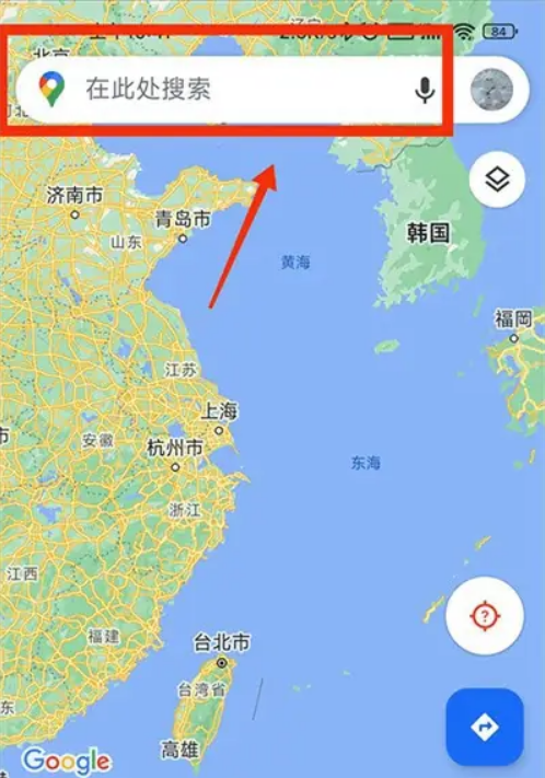
1. Open the Google Maps app and click on the search bar.
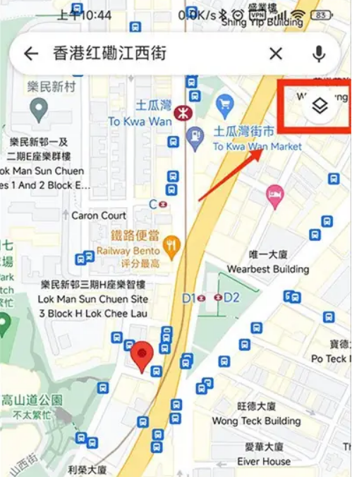
2. Click on the icon as shown.
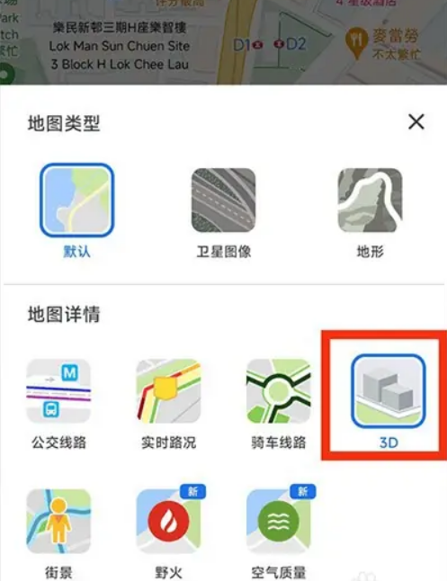
3. Click 3D.
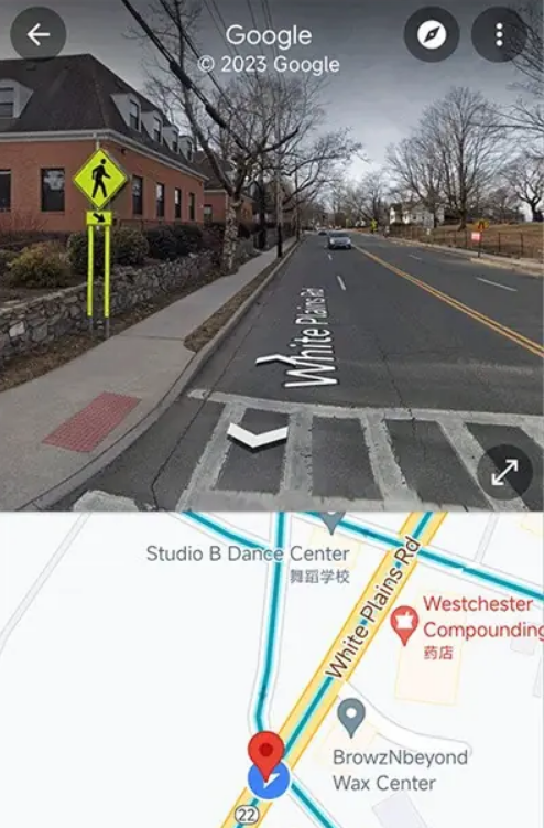
4. Click on the small window.

5. You can view the 3D street view map.
The above is the detailed content of How to open Google Maps 3D satellite map mode. For more information, please follow other related articles on the PHP Chinese website!