Home >Technology peripherals >It Industry >Amap launches new features: mileage pile data service upgrade, new mileage pile number query and longitude and latitude matching pile number functions
Amap launches new features: mileage pile data service upgrade, new mileage pile number query and longitude and latitude matching pile number functions
- WBOYWBOYWBOYWBOYWBOYWBOYWBOYWBOYWBOYWBOYWBOYWBOYWBforward
- 2023-09-16 17:29:012261browse
According to news from this site on September 16, Amap officially announced the launch of a new function of "mileage pile data service". Based on Amap's precise map data and mileage pile collection and positioning technology, covers more than 95% of the country's highway mileage , the dynamic conversion capability of station numbers is accurate to the meter level. The average precision of standard-precision products is 10 meters, and that of high-precision products reaches 10 centimeters.
This site learned from the official that this service provides a variety of functions for highway users, including mileage station number query, longitude and latitude matching station number, station number to longitude and latitude, station number corresponding road dynamic and static information query, etc.
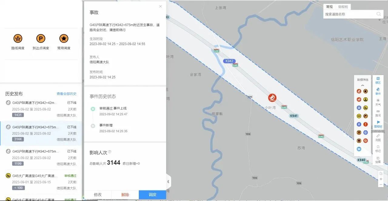
Coordinate to Stake: Used in scenarios such as accidents and road rescues to quickly locate rescue users and achieve the integration of mapping, planning, and dispatching .
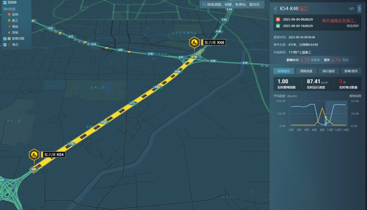
station number to coordinate: Used for information release scenarios, owner's internal construction, accidents, closures and other station number text information, automatically converted into longitude and latitude, quickly implemented Spatialization.
Dynamic and static information query: You can quickly retrieve corresponding road information, query related road conditions, congestion index, events and other information through the station number.
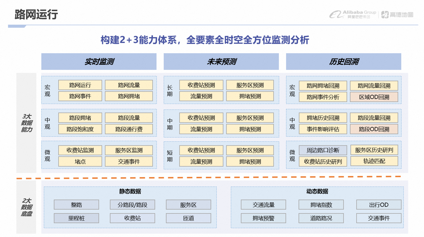
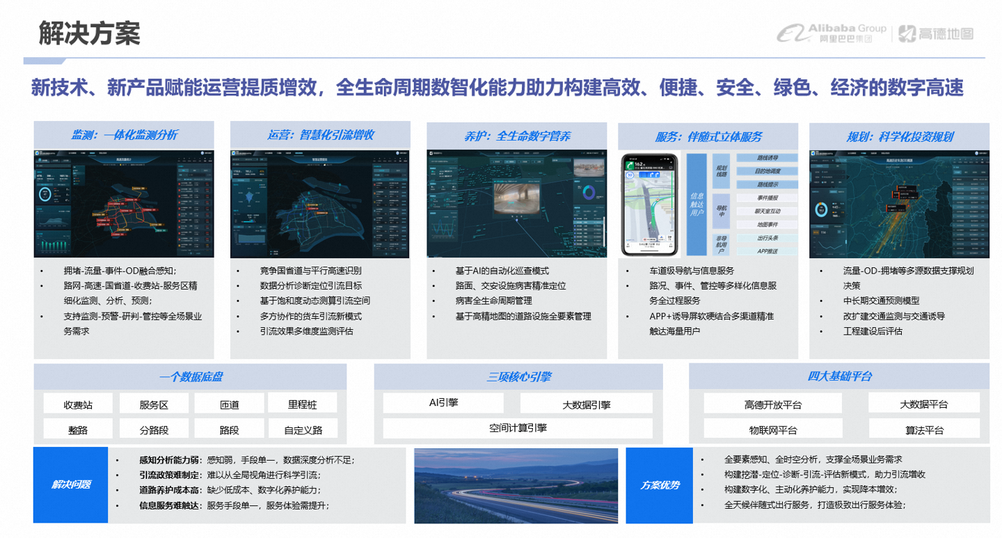
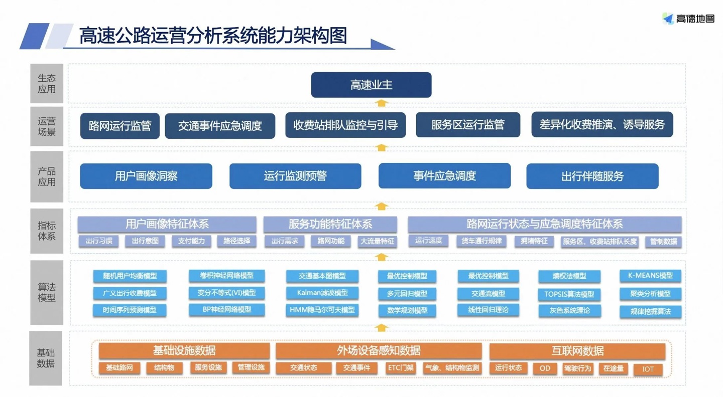
#Mileage pile number query service: You can obtain branch road pile numbers and realize the spatialization of pile number positions for Monitoring and early warning, visualization in the above picture. It also supports road station number retrieval and rapid positioning.
Local chainage service: It can quickly locate and query the location information service of the highway section corresponding to the local chainage data, and realize the road name mileage chainage retrieval capability. For example, G7521 Yuzhu Expressway K210-K238 Zunyi section can be mapped to Zunyi Ring Expressway K102-K130.
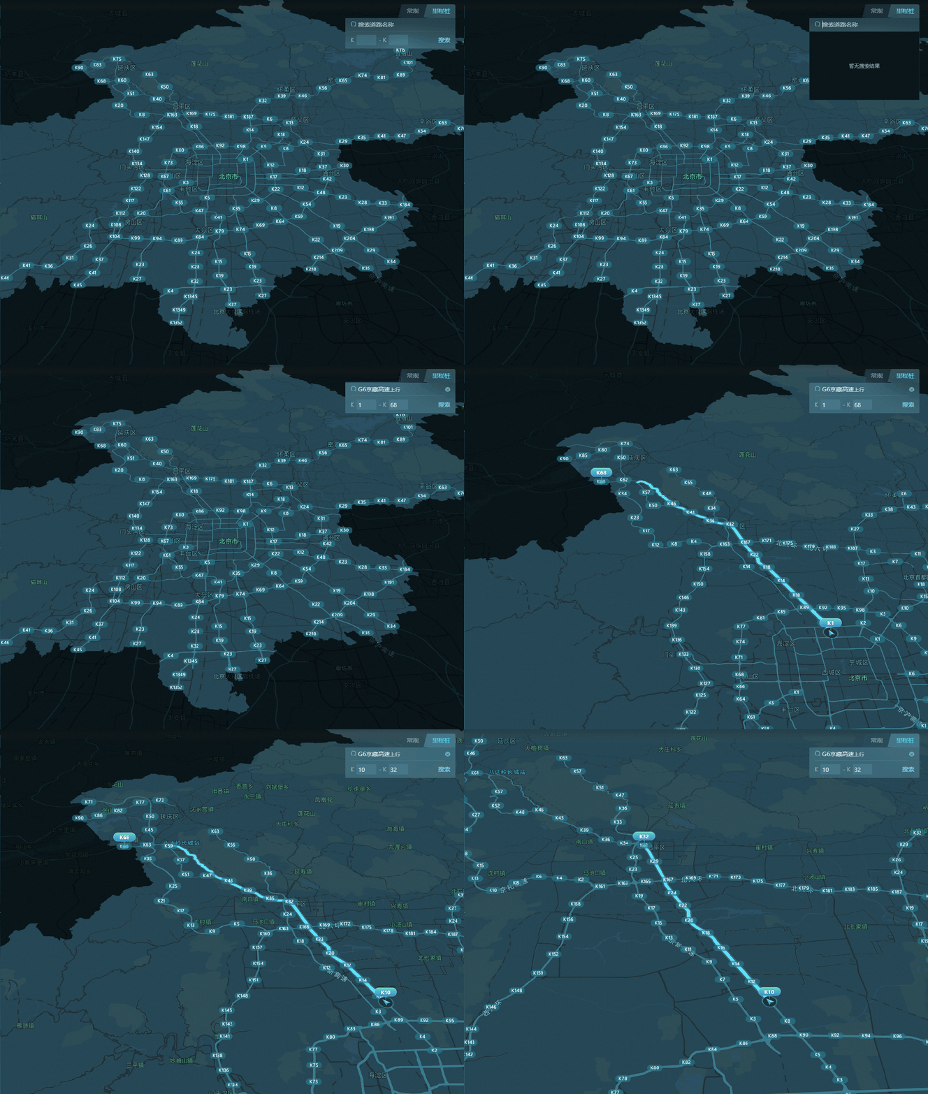
Road related query: Corresponding road segment ID through the station number, Find designated road sections among road information, traffic conditions, events, and index services to achieve multi-service linkage. For example, the start and end location information of the road, road length, number of lanes, speed limit, etc. In addition, the mileage station number retrieval service can also query relevant road facility information such as toll stations and service areas, helping users obtain more comprehensive road information.
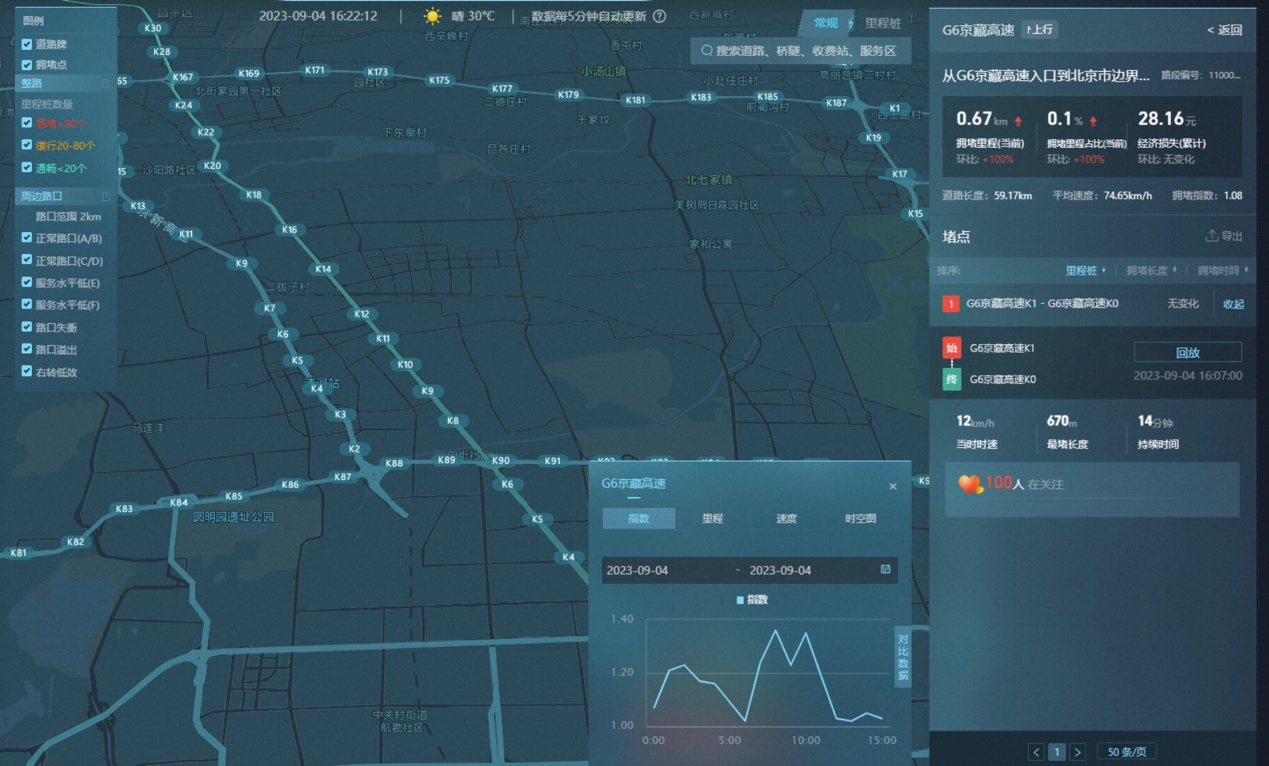
- Coordinate to station number conversion service
: Match coordinates and road relationships to obtain the corresponding station number position accurate to meters. Supports single-point query, direction, up/down, and fuzzy specification of road names. It can be used to implement graphical display and station-based map calculation scenarios.
- Station number to coordinate
: Convert the text information of the entire kilometer and meter into road coordinates, and calculate the longitude and latitude along the road with accuracy to the meter level. Realize text spatialization, information release, user notification, and effect evaluation closed loop.
Advertising statement: The external jump links (including but not limited to hyperlinks, QR codes, passwords, etc.) contained in the article are used to convey more information and save selection time. The results are for reference only. All articles on this site all contain this statement.
The above is the detailed content of Amap launches new features: mileage pile data service upgrade, new mileage pile number query and longitude and latitude matching pile number functions. For more information, please follow other related articles on the PHP Chinese website!
Related articles
See more- Java+js or mysql calculates the distance between two coordinates in the Gaode map
- How can mini programs implement functions similar to friend circle positioning (Amap)
- What is render.js? How to use it to draw Amap in UNiAPP?
- An introduction to the longitude and latitude conversion tool using Java to develop the Amap API
- How to call Amap API through Java code to implement path planning function

