Home >Web Front-end >JS Tutorial >Gaode Map-Plot outbound and return routes
Gaode Map-Plot outbound and return routes
- 黄舟Original
- 2017-02-18 13:52:493311browse
1. Problem background
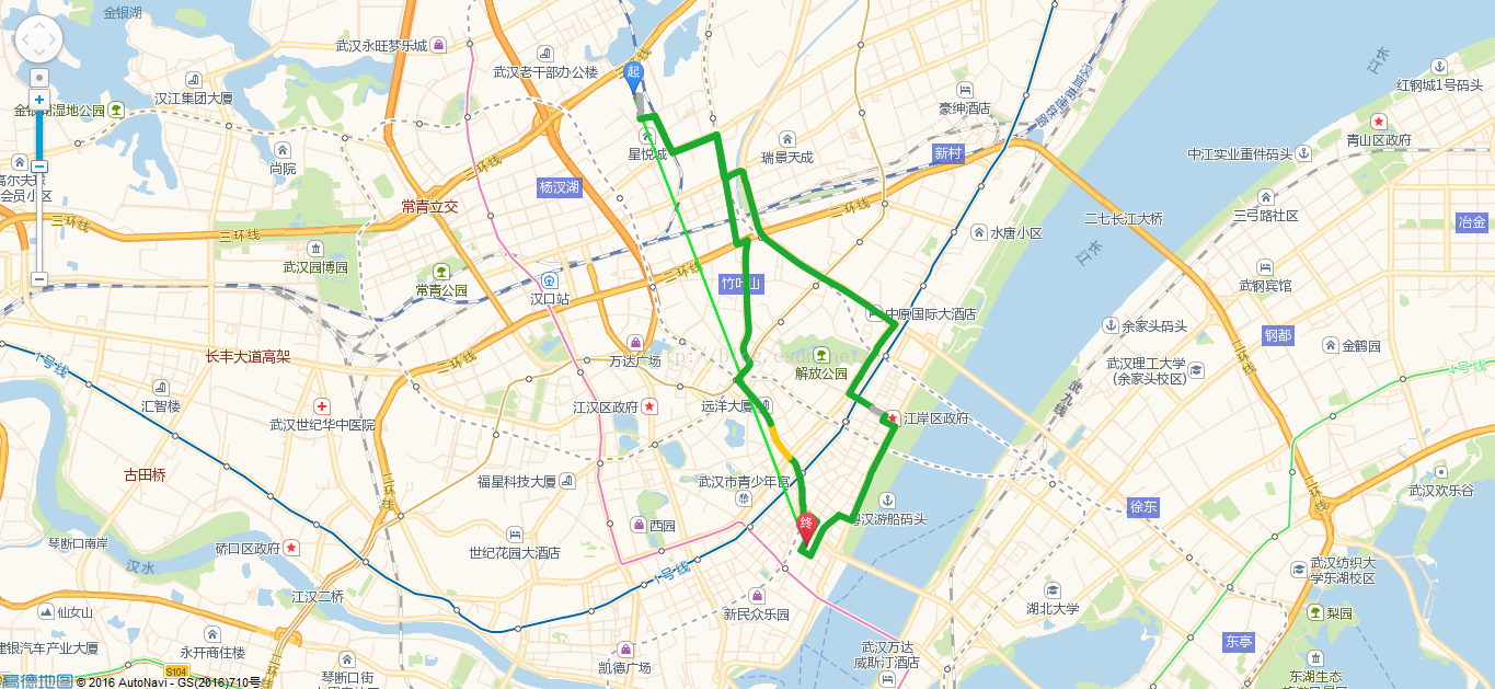
Set the route map for the outbound and return journey, and set the route with different colors
2. Implementation source code
<!doctype html>
<html>
<head>
<meta charset="utf-8">
<meta http-equiv="X-UA-Compatible" content="IE=edge">
<meta name="viewport" content="initial-scale=1.0, user-scalable=no, width=device-width">
<title>高德地图-绘制去程和回程路线</title>
<link rel="stylesheet" href="http://cache.amap.com/lbs/static/main1119.css"/>
<script type="text/javascript" src="http://webapi.amap.com/maps?v=1.3&key=323b2a75430429a747a32b5c318f7f5a&plugin=AMap.Driving"></script>
<script type="text/javascript" src="http://cache.amap.com/lbs/static/addToolbar.js"></script>
<style type="text/css">
#panel {
position: fixed;
background-color: white;
max-height: 90%;
overflow-y: auto;
top: 10px;
right: 10px;
width: 280px;
}
</style>
</head>
<body>
<p id="container"></p>
<p id="panel" style="display:none;"></p>
<script type="text/javascript">
//初始化地图
var map = new AMap.Map("container", {
resizeEnable: true,
center: [114.295482,30.582582],
zoom: 13
});
//初始化导航类
var driving = new AMap.Driving({
map: map,
panel: "panel"
});
// 起点到终点
driving.search(new AMap.LngLat(114.295482,30.582582), new AMap.LngLat(114.26836,30.643449));
var lineArr = [
[114.295482,30.582582],
[114.26836,30.643449]
];
var lineArr1 = [
[114.26836,30.643449],
[114.295482,30.582582]
];
var polyline = new AMap.Polyline({
path: lineArr, // 设置线覆盖物路径
strokeColor: '#3366FF', // 线颜色
strokeOpacity: 1, // 线透明度
strokeWeight: 2, // 线宽
strokeStyle: 'solid', // 线样式
strokeDasharray: [10, 5], // 补充线样式
geodesic: true // 绘制大地线
});
polyline.setMap(map);
//初始化导航类
var driving1 = new AMap.Driving({
map: map,
panel: "panel"
});
//终点到起点
driving1.search(new AMap.LngLat(114.26836,30.643449), new AMap.LngLat(114.295482,30.582582));
var polyline1 = new AMap.Polyline({
path: lineArr, // 设置线覆盖物路径
strokeColor: '#00FF00', // 线颜色
strokeOpacity: 1, // 线透明度
strokeWeight: 2, // 线宽
strokeStyle: 'solid', // 线样式
strokeDasharray: [10, 5], // 补充线样式
geodesic: true // 绘制大地线
});
polyline1.setMap(map);
</script>
</body>
</html>
3. Implementation result

# That’s it Amap - content for drawing outbound and return routes. For more related content, please pay attention to the PHP Chinese website (www.php.cn)!
Statement:
The content of this article is voluntarily contributed by netizens, and the copyright belongs to the original author. This site does not assume corresponding legal responsibility. If you find any content suspected of plagiarism or infringement, please contact admin@php.cn
Previous article:AngularJS $window window objectNext article:AngularJS $window window object
Related articles
See more- An in-depth analysis of the Bootstrap list group component
- Detailed explanation of JavaScript function currying
- Complete example of JS password generation and strength detection (with demo source code download)
- Angularjs integrates WeChat UI (weui)
- How to quickly switch between Traditional Chinese and Simplified Chinese with JavaScript and the trick for websites to support switching between Simplified and Traditional Chinese_javascript skills

