Introduction to Geofence Polygon Drawing Using Java to Develop Amap API
Geofence is a technical means used to determine whether a geographical location is within a specified area and can be used in many scenarios. For example, motion trajectory analysis, electronic fence alarm, etc. The Amap API provides a polygon drawing function for geofences, which makes it easy to mark on the map and determine whether a certain location is within a specified area. The following will introduce how to use Java to develop the geofence polygon drawing function of the Amap API.
First of all, you need to introduce the Java SDK of Amap Map API. You can add the following dependencies in the project's pom.xml file:
<dependency>
  <groupId>com.amap.api</groupId>
  <artifactId>amap-java-sdk</artifactId>
  <version>1.4.0</version>
</dependency>
Then, introduce relevant classes and interfaces into the code:
import com.amap.api.maps.AMap;
import com.amap.api.maps.AMapOptions;
import com.amap.api.maps.CameraUpdateFactory;
import com.amap.api.maps.MapView;
import com.amap.api.maps.model.LatLng;
import com.amap.api.maps.model.LatLngBounds;
import com.amap.api.maps.model.Polygon;
import com.amap.api.maps.model.PolygonOptions;
Next, create a map view object and add Add it to the layout:
MapView mapView = new MapView(context, new AMapOptions());
layout.addView(mapView);
Then, initialize the map object, and set the display position and zoom level of the map:
AMap aMap = mapView.getMap();
aMap.moveCamera(CameraUpdateFactory.newLatLngZoom(new LatLng(39.90923, 116.397428), 10));
Next, create a polygon coordinate collection and add the polygon's Each vertex coordinate:
List<LatLng> points = new ArrayList<>();
points.add(new LatLng(39.910698, 116.399406));
points.add(new LatLng(39.909819, 116.405778));
points.add(new LatLng(39.919719, 116.405814));
points.add(new LatLng(39.919657, 116.399362));
Then, create a polygon options object and set various properties of the polygon:
PolygonOptions polygonOptions = new PolygonOptions();
polygonOptions.addAll(points);
polygonOptions.strokeColor(Color.RED);
polygonOptions.fillColor(Color.argb(50, 255, 0, 0));
polygonOptions.strokeWidth(10);
Next, add the polygon to the map through the map's addPolygon method , and get the polygon object:
Polygon polygon = aMap.addPolygon(polygonOptions);
Finally, you can use the geofence function by judging whether a location is within the polygon:
LatLng location = new LatLng(39.913678, 116.403873);
boolean contains = polygon.contains(location);
System.out.println("该位置是否在多边形内:" + contains);
The above is how to use Java to develop the Amap API An introduction and sample code for geofence polygon drawing. You can easily draw a polygon through the map's addPolygon method, and you can use the contains method of the Polygon object to determine whether a location is within the polygon. The polygon drawing function of geofence can be widely used in location-related businesses, providing developers with more accurate location judgment and analysis capabilities. Hope this article helps you!
The above is the detailed content of Introduction to geofence polygon drawing using Java to develop Amap API. For more information, please follow other related articles on the PHP Chinese website!
 高德地图读秒红绿灯原理是什么Jul 28, 2023 pm 02:16 PM
高德地图读秒红绿灯原理是:1、通过高德地图的实时交通数据实现的;2、利用其强大的算法和人工智能技术,对收集到的交通数据进行处理和分析;3、根据路口的车辆流量、交通拥堵情况等素进行预测和计算,从而提供更准确的红绿灯剩余时间;4、根据用户的位置和目的地信息,计算出用户行驶的路线。
 建筑ppt可以直接绘制平面图吗Mar 20, 2024 am 08:43 AM
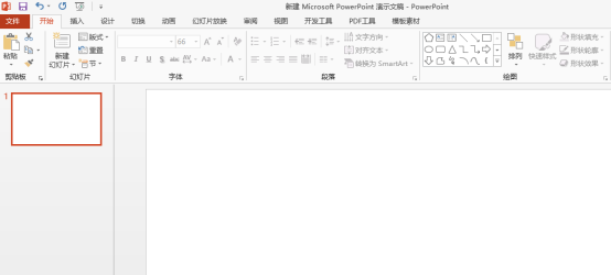
ppt在很多领域和工作中被广泛使用,教育类、建筑类等等的使用更是普遍。提到建筑ppt,肯定我们首先想到的是一些建筑类图纸的呈现,如果我们没有使用专业图纸绘画软件,能不能直接绘制简单的建筑平面图呢?其实,这里,我们是可以完成操作的,下边,我们就绘制一个比较简单的平面图,给大家一个思路,希望大家能够在这个思路下完成更好的平面图绘制。1、首先,我们双击打开桌面上ppt软件,单击新建演示空白文档。2、我们在菜单栏找到插入→形状→矩形。3、绘制矩形完成,随后,双击图形,我们修改填充颜色类型,这里我们可以修
 如何使用Java在OpenCV中绘制带箭头的线条?Aug 20, 2023 pm 02:41 PM
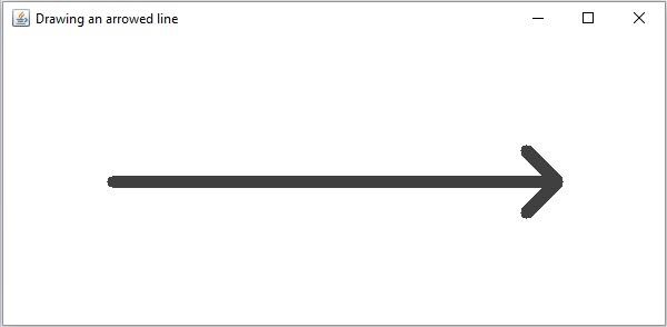
JavaOpenCV库的org.opencv.imgproc包包含一个名为Imgproc的类,该类提供了各种方法来处理输入图像。它提供了一组在图像上绘制几何形状的方法。要绘制一个带箭头的线条,您需要调用这个类的arrowedLine()方法。该方法接受以下参数:表示要在其上绘制线条的图像的Mat对象。表示线条之间的两个点的Point对象。drawn.表示线条颜色的Scalar对象。(BGR)表示线条厚度的整数(默认值:1)。示例importorg.opencv.core.Core;importo
 如何用Python绘制3D地理图表Sep 28, 2023 am 10:19 AM
如何用Python绘制3D地理图表概述:绘制3D地理图表可以帮助我们更直观地理解地理数据和空间分布。Python作为一种功能强大且易于使用的编程语言,提供了许多库和工具,可用于绘制各种类型的地理图表。在本文中,我们将学习如何使用Python编程语言和一些流行的库,如Matplotlib和Basemap,来绘制3D地理图表。环境准备:在开始之前,我们需要确保已
 如何使用Python在图片上绘制几何形状Aug 18, 2023 pm 01:02 PM
如何使用Python在图片上绘制几何形状引言:Python作为一种强大的编程语言,不仅可以进行数据处理和机器学习等高级技术,还可以进行图像处理和图形绘制。在图像处理中,经常需要在图片上绘制各种几何形状,本文将介绍如何使用Python来实现在图片上绘制几何形状的方法。一、环境准备和库安装在开始之前,我们首先需要安装Python的几个必要库,主要包括OpenCV
 五分钟学会用Python绘制树状图和雷达图Sep 27, 2023 pm 12:48 PM
五分钟学会用Python绘制树状图和雷达图在数据可视化中,树状图和雷达图是两种常用的图表形式。树状图用于展示层级结构,而雷达图则用于比较多个维度的数据。本文将介绍如何使用Python绘制这两种图表,并提供具体的代码示例。一、绘制树状图Python中有多个库可以用于绘制树状图,如matplotlib和graphviz。下面以使用matplotlib库为例,演示
 三分钟学会用Python绘制线形图、柱状图和饼图Sep 27, 2023 am 09:29 AM
三分钟学会用Python绘制线形图、柱状图和饼图Python是一种非常流行的编程语言,广泛应用于数据分析和可视化。在这篇文章中,我们将学习如何使用Python绘制三种常见的图表:线形图、柱状图和饼图。我将为你提供具体的代码示例,以帮助你快速上手。线形图线形图是一种通过连接数据点来显示趋势变化的图表类型。在Python中,我们可以使用matplotlib库来绘
 技巧大揭秘:用Python绘制漂亮的3D图表Sep 28, 2023 pm 01:01 PM
技巧大揭秘:用Python绘制漂亮的3D图表引言:在数据可视化领域,制作漂亮的3D图表能够更直观地展示数据的特征和趋势。Python作为一种功能强大的编程语言,拥有众多的库和工具,能够帮助我们实现这一目标。本文将分享一些Python绘制漂亮的3D图表的技巧和具体代码示例,帮助读者更好地理解和应用。一、准备工作:在开始之前,我们需要安装几个必要的Python库


Hot AI Tools

Undresser.AI Undress
AI-powered app for creating realistic nude photos

AI Clothes Remover
Online AI tool for removing clothes from photos.

Undress AI Tool
Undress images for free

Clothoff.io
AI clothes remover

AI Hentai Generator
Generate AI Hentai for free.

Hot Article

Hot Tools

Dreamweaver CS6
Visual web development tools

Zend Studio 13.0.1
Powerful PHP integrated development environment

Safe Exam Browser
Safe Exam Browser is a secure browser environment for taking online exams securely. This software turns any computer into a secure workstation. It controls access to any utility and prevents students from using unauthorized resources.

SublimeText3 Mac version
God-level code editing software (SublimeText3)

Atom editor mac version download
The most popular open source editor


