


The power of Google Maps is much more than navigation. Even if you already know the destination route, it offers many conveniences. Let's explore more of the use of the map and open up a new experience beyond navigation.
-
Avoid congestion: Even if you know the way to the supermarket, you cannot predict traffic conditions. Google Maps can display real-time traffic conditions in seconds. In the browser, find the target area and click the Road condition label in the left panel (if there is no panel, click the in the upper left corner of the map with the white label with the right arrow). This tag will display road conditions information, and after clicking, a color map overlay will be displayed, which will indicate the vehicle density of each street in detail. Please make sure the menu at the bottom of the map is set to display Real-time traffic conditions . In the mobile app, click the layer icon in the upper right corner (looks like two superimposed diamonds) and select Road Conditions . You can use this information to plan new routes, but we are here to avoid navigation! You can view the map from time to time until traffic jams are eased. Your Android or iOS app should refresh automatically, but you may need to manually reload the browser page.
-
Measurement distance: Want to know the straight line distance from Chicago to the Mediterranean Republic of Malta? Or would you like to show off your wonderful shot on the golf course last weekend? Google Maps can help you do it. In your browser, right-click anywhere on the map and select Measure distance from the menu that appears. Then, click on another location. You can click and drag the anchor points at both ends of the measurement line, click the middle position and drag it to the middle position, or click another position to add another point. Operation on a mobile phone is a little more complicated. First, click on the map to display the red location pin. Then, click on the pushpin. Select Measure distance and drag the map to select the end point. After determining the position, click to add point or the plus icon in the lower right corner of the screen. You can't change points or jump to the middle of the line, but you can click the undo icon at the top of the screen (a curved left arrow) to take a step back at once.
-
View the interior of the building: Google Street View has been around for years, but you may have touched only its surface. Of course, you may have used it to virtually cruise the roads in remote parts of the world, but you can also use it to peek inside buildings or even visit museums. For example, look at the American Museum of Natural History in New York City. In the browser window, grab the little yellow villain (Pegman)'s hand and drag his loose body to the map. In addition to the road highlighted in blue, you will also see a maze of paths inside the building. Put your digital companion in the museum and you will see what the interior looks like. From there, navigation is the same as navigation in Street View: Tap and drag to rotate the camera and use the on-screen arrow or the computer's arrow keys to navigate. On your phone, click the layer icon in the upper right corner, and select Street View. This will highlight the viewable area in blue, and you can click a location to enter. Then, tap and drag the screen to move and look around. You can also use Street View to access other places, so it's worth searching for if a particularly interesting site supports this feature. You may even encounter it randomly in unexpected areas.
Rewind time: Street View shows the latest image of the area by default, but you can see what the area (and elsewhere) near you looked like over a decade ago. The first step is very familiar: grab the yellow character, place it on the map, and move it around. However, to see how an area used to look like, go to the gray box in the upper left corner of the screen and click the Clock icon next to Street View. Drag the slider at the bottom of the pop-up to see what happened in the same position over the years, and then click on the image to load the year into the main view for browsing. Unfortunately, this "Time Travel" option is not available on your phone and you can only use it in your browser.
Understanding parking space availability: -
Android and iOS apps lack Street View, so we'll cover a phone-only feature: predicting parking availability at a specific location (to some extent). Enter the route for a certain location (even if you know exactly how to get there), you may see a small parking lot icon next to the route's itinerary and distance measurement. Possible assessments are: Limited, Medium and Easy. Swipe up to see the steps and Google may tell you about the typical parking situation where you are going. Now, Google can’t tell you if the only available parking space is slightly smaller than your car, or if the area actually smells like rotten farts due to a sewage leak. It just does its best. Just like all of us.
The above is the detailed content of 5 uses for Google Maps beyond navigation. For more information, please follow other related articles on the PHP Chinese website!

 A Step-by-Step Guide to Copy ESXi VM to a USB DriveMay 03, 2025 pm 08:01 PM
Offsite VM backups are crucial. This guide demonstrates how to easily copy ESXi virtual machines to a USB drive for secure, accessible storage. Method 1: Manual VM File Download This method copies the core VM files. Power off the target VM in the V
 Windows 10 KB5055612: New Features & What if It Failed to InstallMay 02, 2025 pm 08:01 PM
This non-security update, KB5055612 for Windows 10 version 22H2 and related versions, released April 22, 2025, offers several quality improvements. This guide details installation and troubleshooting steps. KB5055612: Key Improvements This update enh
 Unlock Helpful Methods to Fix KB5055642 Not InstallingMay 02, 2025 pm 06:01 PM
Troubleshooting KB5055642 Installation Problems on Windows 11 This guide offers solutions for users encountering issues installing Windows 11 Insider Preview Build 26200.5562 (KB5055642), released April 21, 2025. This update introduces enhanced featu
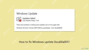 How to fix Windows update error 0xca00a000?May 02, 2025 pm 06:00 PM
Updates are vital to ensure that a Windows system runs well and is protected from potential outside threats, such as software vulnerabilities. Unfortunately, Wi
 Learn How to Resolve Steam Invalid Platform Error on WindowsMay 01, 2025 pm 06:01 PM
Encountering the Steam "Invalid Platform" error? This MiniTool guide offers several solutions to get you back in the game. This frustrating error typically means your game is incompatible with your operating system. Understanding the Error
 How to fix Xbox app error 0x80073cf9 in Windows?May 01, 2025 am 02:00 AM
The Windows Xbox app lets you manage your Game Pass library, view friends, and launch PC games from one place. Its a hub of Microsofts gaming experience, especi
 Fix VMWare Slow System Performance in Windows 11Apr 30, 2025 pm 08:14 PM
VMware Workstation on Windows 11: Troubleshooting Slow Performance Experiencing sluggish system performance after installing VMware Workstation on your Windows 11 desktop? This guide offers practical solutions to resolve this common issue. Quick Nav
 Community Tips for Oblivion Remastered Low FPS/Stuttering PCApr 30, 2025 pm 08:13 PM
Many players have encountered frustrating low FPS, stuttering, and lagging issues in Oblivion Remastered. This MiniTool guide offers several effective solutions to boost your gameplay performance. Quick Navigation: Oblivion Remastered Performance Pr


Hot AI Tools

Undresser.AI Undress
AI-powered app for creating realistic nude photos

AI Clothes Remover
Online AI tool for removing clothes from photos.

Undress AI Tool
Undress images for free

Clothoff.io
AI clothes remover

Video Face Swap
Swap faces in any video effortlessly with our completely free AI face swap tool!

Hot Article
Hot Tools

WebStorm Mac version
Useful JavaScript development tools

SublimeText3 Chinese version
Chinese version, very easy to use

Dreamweaver CS6
Visual web development tools

SAP NetWeaver Server Adapter for Eclipse
Integrate Eclipse with SAP NetWeaver application server.

MantisBT
Mantis is an easy-to-deploy web-based defect tracking tool designed to aid in product defect tracking. It requires PHP, MySQL and a web server. Check out our demo and hosting services.

