

 Technology peripheralsAIPutting the entire earth into a neural network, the Beihang University team launched a global remote sensing image generation model
Beihang University’s research team used a diffusion model to “replicate” the Earth?
At any location around the world, the model can generate remote sensing images of multiple resolutions, creating rich and diverse "parallel scenes."
Moreover, complex geographical features such as terrain, climate, and vegetation have all been taken into consideration.

Inspired by Google Earth, Beihang's research team "loaded" satellite remote sensing images of the entire Earth into a deep neural network from an overhead perspective.
Based on such a network, the team built MetaEarth, a global top-down visual generation model.
MetaEarth has 600 million parameters and can generate remote sensing images with multiple resolutions, unbounded and covering any geographical location around the world.

Remote sensing image generation model with global coverage
Compared with previous research, building a world-wide basic visual generation model is more challenging. Many difficulties were overcome.
Model capacity is a challenge because the Earth has a wide range of geographical features such as cities, forests, deserts, oceans, glaciers, and snowfields, which need to be understood and represented by the model.
Even the same type of man-made features will show huge differences under different latitudes, climates and cultural environments, which places high demands on the capacity of the generated model.
MetaEarth successfully solved this difficulty and achieved high-resolution, large-scale scene generation in different locations and landforms.

#In addition, achieving the generation of remote sensing images with controllable resolution is also a challenge.
Because in the overhead image imaging process, the display of ground feature features is greatly affected by the resolution. There are obvious differences under different image resolutions. It is difficult to achieve the specified resolution (meter/meter/ Pixels)The ability to accurately generate.
When MetaEarth generates images of different resolutions, it can accurately and reasonably present surface features, and the correlations between different resolutions are also accurately mapped.

Finally, there is the challenge of unbounded image generation - unlike daily natural images, remote sensing images have the characteristics of ultra-large width, and the side length may reach tens of thousands of pixels. Previous methods It is difficult to generate continuous, unbounded images of arbitrary sizes.
But the continuous unbounded scene generated by MetaEarth avoids this defect, and you can see that the image moves very smoothly as the "lens" is translated.

In addition, MetaEarth has strong generalization performance and can generate multi-resolution images in cascade with unknown scenes as conditional input.
For example, if the "Pandora Planet" generated by GPT4-V is input into the model as the initial condition, MetaEarth is still able to generate images with reasonable distribution of ground objects and realistic details.

The verification results on downstream missions show that MetaEarth, as a brand-new data engine, is expected to provide virtual environment and training data support for various downstream missions in the field of earth observation.
During the experiment, the author chose the basic task of remote sensing image classification for verification. The results show that with the assistance of high-quality images generated by MetaEarth, the classification accuracy of downstream tasks has been significantly improved.

The author believes that MetaEarth is expected to provide a realistic virtual environment for unmanned aerial system platforms such as satellites, and can be used in urban planning, environmental monitoring, disaster management, agricultural optimization, etc. Widely used in many fields;
In addition to being a data engine, MetaEarth also has great potential in building generative world models, providing new possibilities for future research. .
So, how does MetaEarth realize it?
600 million parameter diffusion model "replicates" the earth
MetaEarth is built based on the probabilistic diffusion model and has a parameter scale of more than 600 million.
To support model training, the team collected a large remote sensing image data set, containing images of multiple spatial resolutions covering most regions around the world and their geographic information (latitude, longitude and resolution) .
In this study, the author proposes a resolution-guided self-cascading generation framework.

△The overall framework of MetaEarth
Under this framework, multi-resolution image generation for a given geographical location can be achieved using only a single model, and Create rich and diverse "parallel scenes" at each level of resolution.
Specifically, this is a codec-structured denoising network that combines low-resolution conditional images and spatial resolution encoding with time-step embedding of the denoising process to predict each time step noise to achieve image generation.
In order to generate unbounded images of any size, the author also designed a memory-efficient sliding window generation method and noise sampling strategy.
This strategy divides the generated image into overlapping image blocks as a condition, and uses a specific noise sampling strategy to generate similar content in the shared area of adjacent image blocks, thereby avoiding splicing gaps.
In addition, this noise sampling strategy also enables the model to consume less video memory resources when generating unbounded images of any size.
Team Profile
The author of this study is from the "Learning, Vision and Remote Sensing Laboratory" of Beihang University (LEarning, VIsion and Remote sensing laboratory, LEVIR Lab), the laboratory is led by Professor Shi Zhenwei, a national outstanding student.
Professor Zou Zhengxia, a former doctoral student of Professor Shi Zhenwei, a postdoctoral fellow at the University of Michigan, and a current member of the laboratory, is the corresponding author of this article.
Paper address:https://www.php.cn/link/31bb2feb402ac789507479daf9713b00
Project homepage:https://www.php.cn/link/a0098fd07db7692267fca4f4169c9ba2
The above is the detailed content of Putting the entire earth into a neural network, the Beihang University team launched a global remote sensing image generation model. For more information, please follow other related articles on the PHP Chinese website!

 从VAE到扩散模型:一文解读以文生图新范式Apr 08, 2023 pm 08:41 PM
1 前言在发布DALL·E的15个月后,OpenAI在今年春天带了续作DALL·E 2,以其更加惊艳的效果和丰富的可玩性迅速占领了各大AI社区的头条。近年来,随着生成对抗网络(GAN)、变分自编码器(VAE)、扩散模型(Diffusion models)的出现,深度学习已向世人展现其强大的图像生成能力;加上GPT-3、BERT等NLP模型的成功,人类正逐步打破文本和图像的信息界限。在DALL·E 2中,只需输入简单的文本(prompt),它就可以生成多张1024*1024的高清图像。这些图像甚至
 找不到中文语音预训练模型?中文版 Wav2vec 2.0和HuBERT来了Apr 08, 2023 pm 06:21 PM
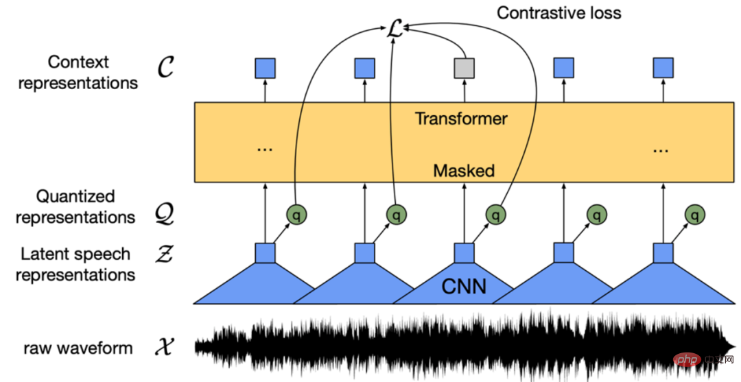
Wav2vec 2.0 [1],HuBERT [2] 和 WavLM [3] 等语音预训练模型,通过在多达上万小时的无标注语音数据(如 Libri-light )上的自监督学习,显著提升了自动语音识别(Automatic Speech Recognition, ASR),语音合成(Text-to-speech, TTS)和语音转换(Voice Conversation,VC)等语音下游任务的性能。然而这些模型都没有公开的中文版本,不便于应用在中文语音研究场景。 WenetSpeech [4] 是
 普林斯顿陈丹琦:如何让「大模型」变小Apr 08, 2023 pm 04:01 PM
“Making large models smaller”这是很多语言模型研究人员的学术追求,针对大模型昂贵的环境和训练成本,陈丹琦在智源大会青源学术年会上做了题为“Making large models smaller”的特邀报告。报告中重点提及了基于记忆增强的TRIME算法和基于粗细粒度联合剪枝和逐层蒸馏的CofiPruning算法。前者能够在不改变模型结构的基础上兼顾语言模型困惑度和检索速度方面的优势;而后者可以在保证下游任务准确度的同时实现更快的处理速度,具有更小的模型结构。陈丹琦 普
 解锁CNN和Transformer正确结合方法,字节跳动提出有效的下一代视觉TransformerApr 09, 2023 pm 02:01 PM
由于复杂的注意力机制和模型设计,大多数现有的视觉 Transformer(ViT)在现实的工业部署场景中不能像卷积神经网络(CNN)那样高效地执行。这就带来了一个问题:视觉神经网络能否像 CNN 一样快速推断并像 ViT 一样强大?近期一些工作试图设计 CNN-Transformer 混合架构来解决这个问题,但这些工作的整体性能远不能令人满意。基于此,来自字节跳动的研究者提出了一种能在现实工业场景中有效部署的下一代视觉 Transformer——Next-ViT。从延迟 / 准确性权衡的角度看,
 Stable Diffusion XL 现已推出—有什么新功能,你知道吗?Apr 07, 2023 pm 11:21 PM
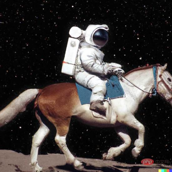
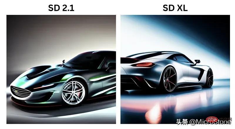
3月27号,Stability AI的创始人兼首席执行官Emad Mostaque在一条推文中宣布,Stable Diffusion XL 现已可用于公开测试。以下是一些事项:“XL”不是这个新的AI模型的官方名称。一旦发布稳定性AI公司的官方公告,名称将会更改。与先前版本相比,图像质量有所提高与先前版本相比,图像生成速度大大加快。示例图像让我们看看新旧AI模型在结果上的差异。Prompt: Luxury sports car with aerodynamic curves, shot in a
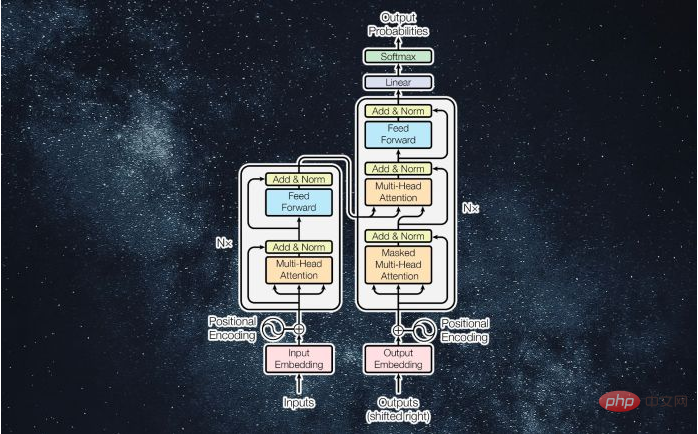 什么是Transformer机器学习模型?Apr 08, 2023 pm 06:31 PM
译者 | 李睿审校 | 孙淑娟近年来, Transformer 机器学习模型已经成为深度学习和深度神经网络技术进步的主要亮点之一。它主要用于自然语言处理中的高级应用。谷歌正在使用它来增强其搜索引擎结果。OpenAI 使用 Transformer 创建了著名的 GPT-2和 GPT-3模型。自从2017年首次亮相以来,Transformer 架构不断发展并扩展到多种不同的变体,从语言任务扩展到其他领域。它们已被用于时间序列预测。它们是 DeepMind 的蛋白质结构预测模型 AlphaFold
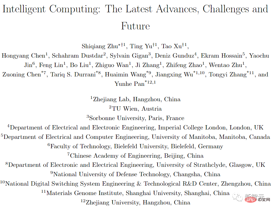 五年后AI所需算力超100万倍!十二家机构联合发表88页长文:「智能计算」是解药Apr 09, 2023 pm 07:01 PM
人工智能就是一个「拼财力」的行业,如果没有高性能计算设备,别说开发基础模型,就连微调模型都做不到。但如果只靠拼硬件,单靠当前计算性能的发展速度,迟早有一天无法满足日益膨胀的需求,所以还需要配套的软件来协调统筹计算能力,这时候就需要用到「智能计算」技术。最近,来自之江实验室、中国工程院、国防科技大学、浙江大学等多达十二个国内外研究机构共同发表了一篇论文,首次对智能计算领域进行了全面的调研,涵盖了理论基础、智能与计算的技术融合、重要应用、挑战和未来前景。论文链接:https://spj.scien
 AI模型告诉你,为啥巴西最可能在今年夺冠!曾精准预测前两届冠军Apr 09, 2023 pm 01:51 PM
说起2010年南非世界杯的最大网红,一定非「章鱼保罗」莫属!这只位于德国海洋生物中心的神奇章鱼,不仅成功预测了德国队全部七场比赛的结果,还顺利地选出了最终的总冠军西班牙队。不幸的是,保罗已经永远地离开了我们,但它的「遗产」却在人们预测足球比赛结果的尝试中持续存在。在艾伦图灵研究所(The Alan Turing Institute),随着2022年卡塔尔世界杯的持续进行,三位研究员Nick Barlow、Jack Roberts和Ryan Chan决定用一种AI算法预测今年的冠军归属。预测模型图


Hot AI Tools

Undresser.AI Undress
AI-powered app for creating realistic nude photos

AI Clothes Remover
Online AI tool for removing clothes from photos.

Undress AI Tool
Undress images for free

Clothoff.io
AI clothes remover

AI Hentai Generator
Generate AI Hentai for free.

Hot Article
Hot Tools

MantisBT
Mantis is an easy-to-deploy web-based defect tracking tool designed to aid in product defect tracking. It requires PHP, MySQL and a web server. Check out our demo and hosting services.

MinGW - Minimalist GNU for Windows
This project is in the process of being migrated to osdn.net/projects/mingw, you can continue to follow us there. MinGW: A native Windows port of the GNU Compiler Collection (GCC), freely distributable import libraries and header files for building native Windows applications; includes extensions to the MSVC runtime to support C99 functionality. All MinGW software can run on 64-bit Windows platforms.

SublimeText3 Mac version
God-level code editing software (SublimeText3)

SublimeText3 English version
Recommended: Win version, supports code prompts!

Zend Studio 13.0.1
Powerful PHP integrated development environment

